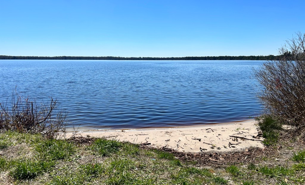
The Bolsa Chica Ecological Reserve Trail is a 4.4-mile loop located near Huntington Beach, California. This moderately trafficked trail offers scenic views of wildflowers and is a haven for birdwatchers, with a wide variety of bird species to observe. As you explore the reserve, you may also encounter marine life, reptiles, and mammals. Be aware that the area is home to both Western Diamondback and Southern Pacific rattlesnakes—venomous species native to the region. Click here for more information and the Do’s and Don’ts when walking in rattlesnake territory.

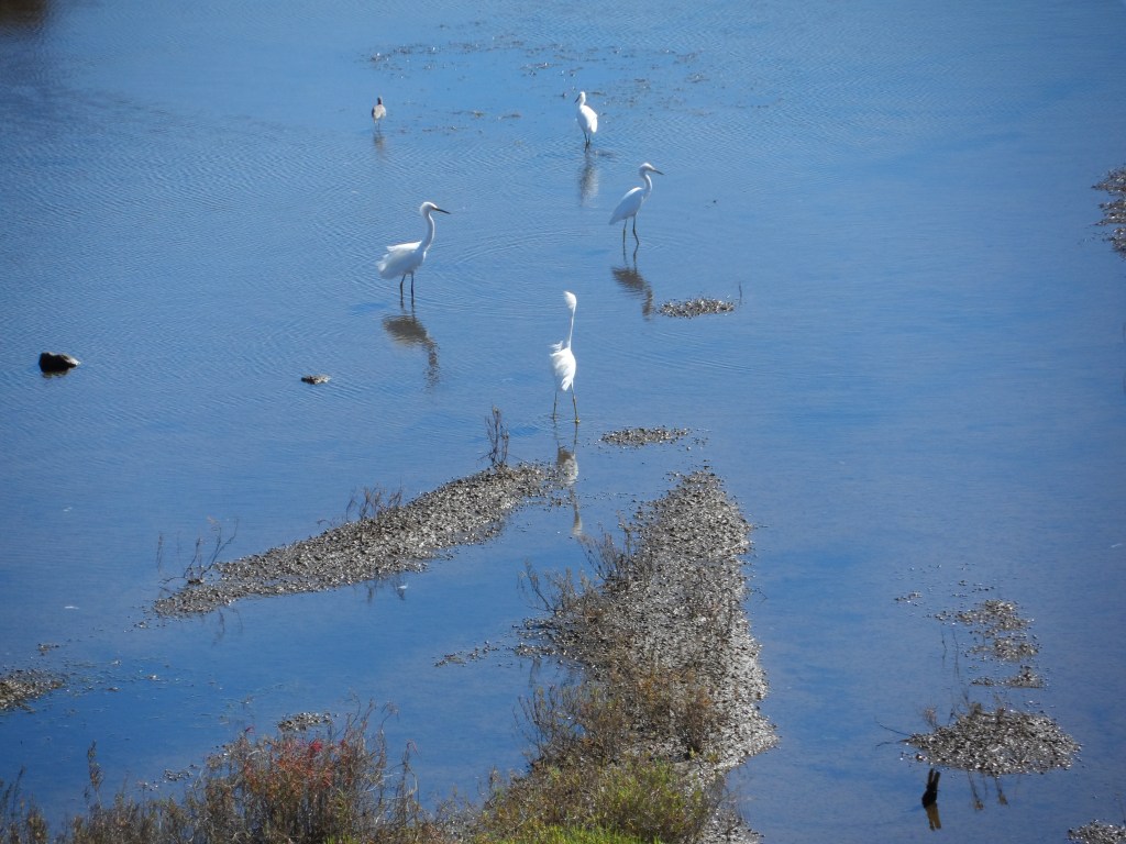
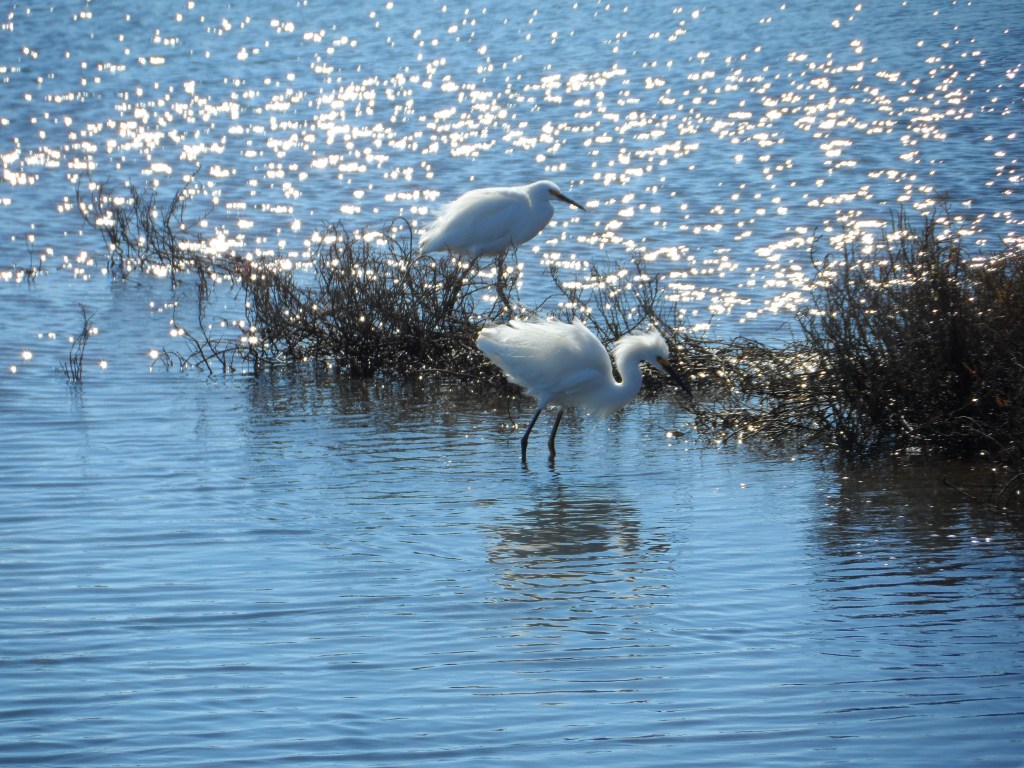
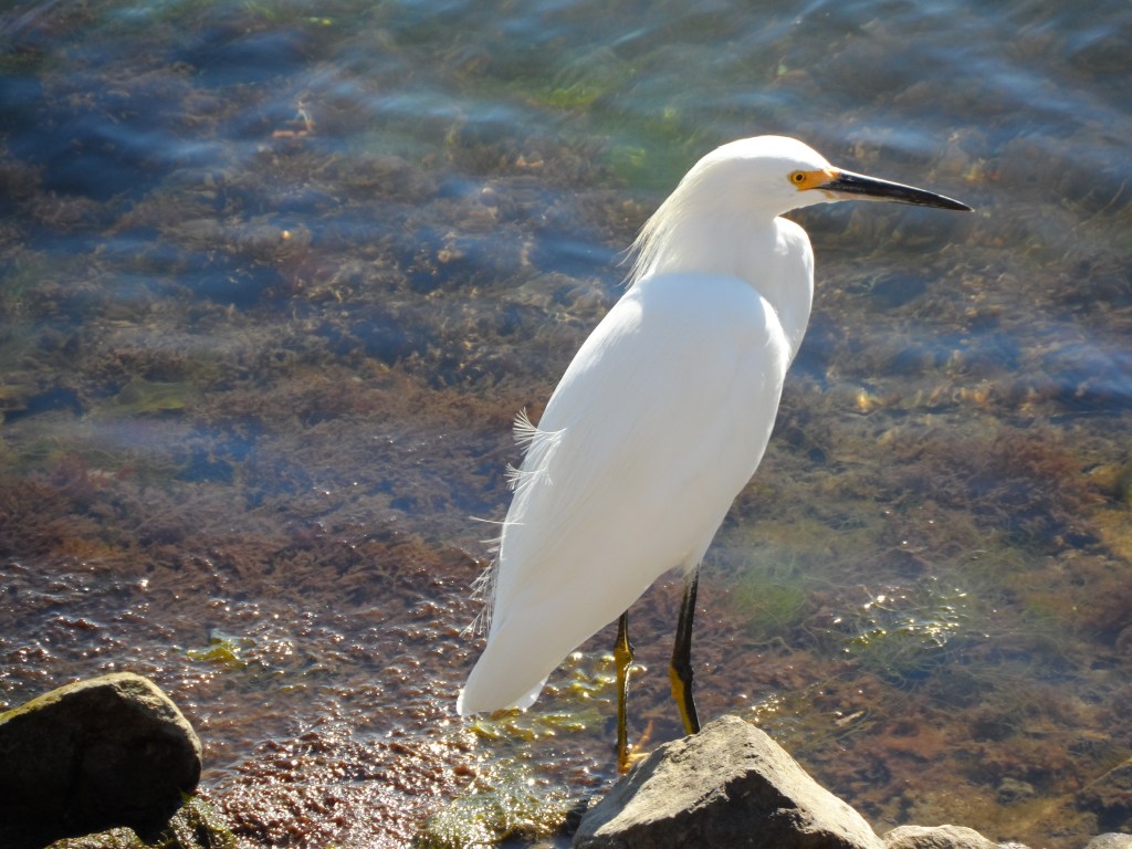
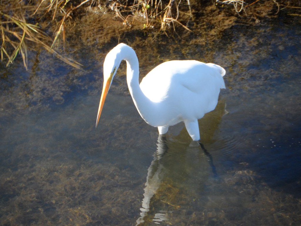
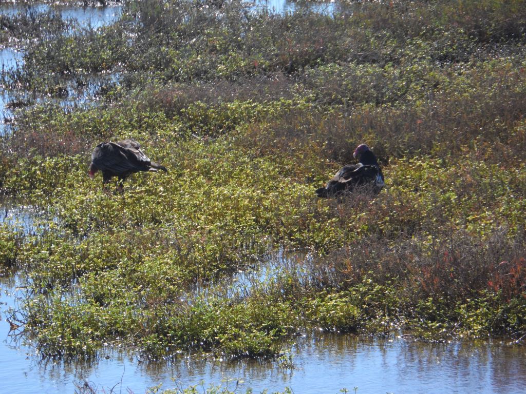
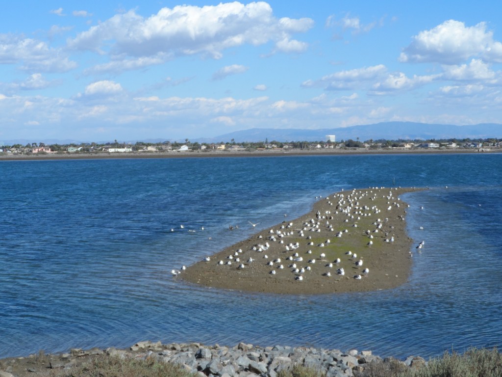
On any given day, the Bolsa Chica wetlands serve as a sanctuary for birds of all kinds—both feathered and human. The human visitors include runners, hikers, and birdwatchers who travel from around the world to witness the vibrant avian display. More than 300 bird species have been observed in this rich habitat, including migratory visitors and nesting residents.
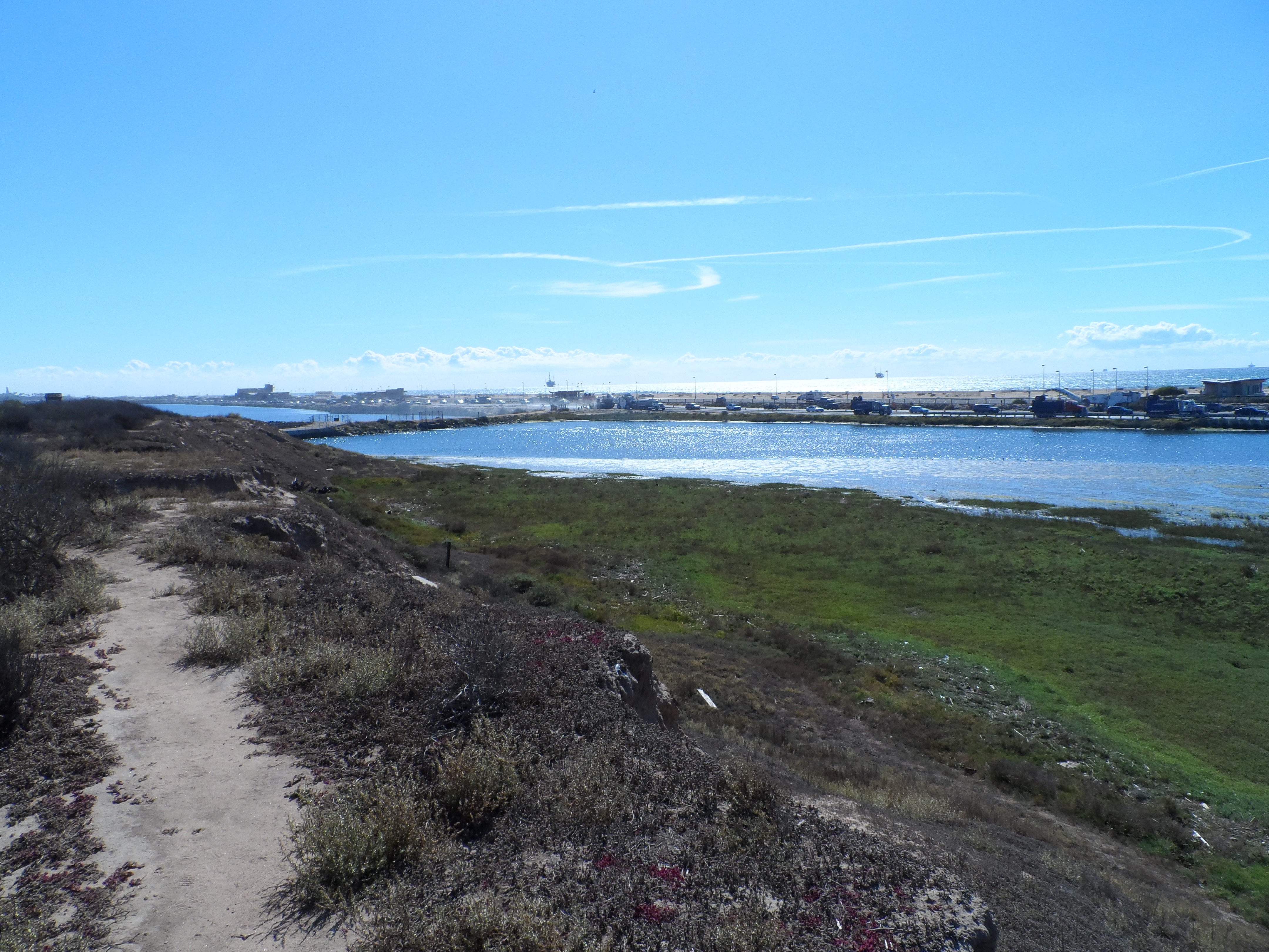
Spanning roughly 1,400 acres, the Bolsa Chica Ecological Reserve is one of the largest remaining saltwater marshes in California. These wetlands are the remnants of a once vast and thriving wetland system. Historically, a tributary of the Santa Ana River known as Freeman Creek flowed into the area, creating a dynamic environment of fresh and saltwater marshes, tidal sloughs, and swamplands. This diverse habitat supported dense vegetation, including tule reeds, arroyo willows, and thick brush.


HISTORY
This remarkably rich estuary has been home to Native American peoples for as long as 8,000 years. Between 6000 and 3500 B.C., a group believed to be Hokan-speaking and ancestors of the Chumash inhabited the area. Although little is known about them, they left behind an important archaeological legacy at Bolsa Chica: the mysterious Cogged Stones.

More than 150 of these enigmatic Cogged Stones have been discovered at various sites throughout the wetlands. Shaped like round disks with carved notches or grooves along their edges, some feature holes in the center while others do not. Their exact purpose remains a mystery. The lack of wear suggests they were not used as tools, but rather served ceremonial or decorative purposes. One prevailing theory is that they may have symbolized celestial bodies—such as the sun, moon, and stars—and were possibly part of an early calendar system.

Between 200 and 500 A.D., Native American groups migrating from the Mojave Desert region of eastern California, Nevada, and Arizona gradually displaced the earlier Hokan-speaking inhabitants of Bolsa Chica. These newcomers were Shoshonean peoples of Uto-Aztecan descent. Among the tribes that later lived in the Bolsa Chica area were the Tongva and the Acjachemen.
In 1542, Spanish explorer Juan Cabrillo sailed along the Southern California coast in search of trade routes and a passage to China. During his journey, he encountered and befriended the Tongva people living on Santa Catalina Island, which he named San Salvador. Sixty years later, fellow explorer Sebastián Vizcaíno also navigated the California coast and met members of the Tongva tribe. His reports described them as friendly and peaceful—a sentiment echoed by later accounts of the region’s Native peoples.

When Mexico overthrew Spanish rule in 1834, the vast Nieto land grant was divided into six large parcels. One of these was acquired by Catarina Ruiz, the widowed daughter-in-law of Manuel Nieto. Her portion included the mouth of the Santa Ana River, and she named it Rancho Las Bolsas (“The Purses”), possibly inspired by the rolling hills in the southern part of the property that resembled purses piled together. From her inheritance, Catarina gifted approximately 8,000 acres to her brother, Joaquin Ruiz. The land featured a single small hill, which he named Rancho La Bolsa Chica—“The Little Purse”—in honor of his sister.
After California became part of the United States in 1848, American settlers began migrating westward in large numbers, rapidly establishing dominance over the region’s economic and social landscape.
Oil was discovered in Huntington Beach in 1920, prompting the Bolsa Chica Gun Club to sign an oil and gas lease with the Standard Oil Company of California. However, drilling in the lowlands did not begin until 1940, when Signal Oil Company assumed the lease. Raised service roads were constructed to provide access to the numerous wells spread throughout the lowlands.
To defend the harbor during World War II, the U.S. Army established an artillery battery on Bolsa Chica Mesa. On May 15, 1942, the War Department acquired land through outright purchases, leases, and permits from 14 different parties, including leases from the Pacific Electric Railway Company.
During World War II, the Army’s Harbor Defenses of Los Angeles, based at Fort MacArthur, utilized the Bolsa Chica site as a shore artillery battery. The northern half of the site was developed with fortifications and buildings, including two gun emplacements, a water tank and tower, a transformer vault, two underground tanks, and electrical and water utility systems. Additional long-range gun emplacements were built on the bluff overlooking Outer Bolsa Bay. Massive concrete bunkers were also constructed to shelter personnel and store munitions.
The ecological reserve has long been open to visitors free of charge, but that may soon change. Starting February 1, 2018, the California Department of Fish and Wildlife planned to require visitors to have either a hunting or fishing license, or to purchase a daily or annual State Lands Pass. Although this fee has been temporarily put on hold, when implemented it will cost $4.32 for a daily pass and $25.10 for an annual pass. Notably, passes won’t be available for purchase on-site unless visitors have a smartphone capable of scanning a QR code. Otherwise, passes must be bought in advance online, by phone, or at participating sporting goods stores.
Passes will not be sold at the Bolsa Chica Conservancy office located on the property. While visitors are not required to display the pass upon entering the wetlands, they must present it if asked by a department officer. Failure to do so can result in citations ranging from $50 to $250.
This trail is good for all skill levels and offers a number of activity options and is accessible year-round. You’ll find trail access from a parking lot on the inland side of Pacific Coast Highway, a mile south of Warner Avenue across from the entrance to Bolsa Chica State Beach or you can park at the Conservancy building lot. Both locations offer free limited parking for nature enthusiasts.
They offer a free public tour on the second Saturday of each month from 10am-12pm and meet at the Interpretive Center (3842 Warner Ave, HB). They also offer private tours for groups. Call 714-846-1114 to sign up
The trails are open from 6am-8pm every day; the Interpretive Center is open from 9am-4pm every day.